Technology

Geospatial infrastructure built for carbon markets

Carbonmetre combines remote sensing, calibrated biomass models, and automated verification pipelines into a single platform designed for audit-ready nature-based carbon projects.

Our stack

From raw imagery to registry exports, every layer of our technology is engineered for traceability, repeatability, and alignment with international MRV standards. Data flows through controlled pipelines so your team can defend every tonne with evidence.

High-altitude aerial and satellite imagery acquisition
Acquisition

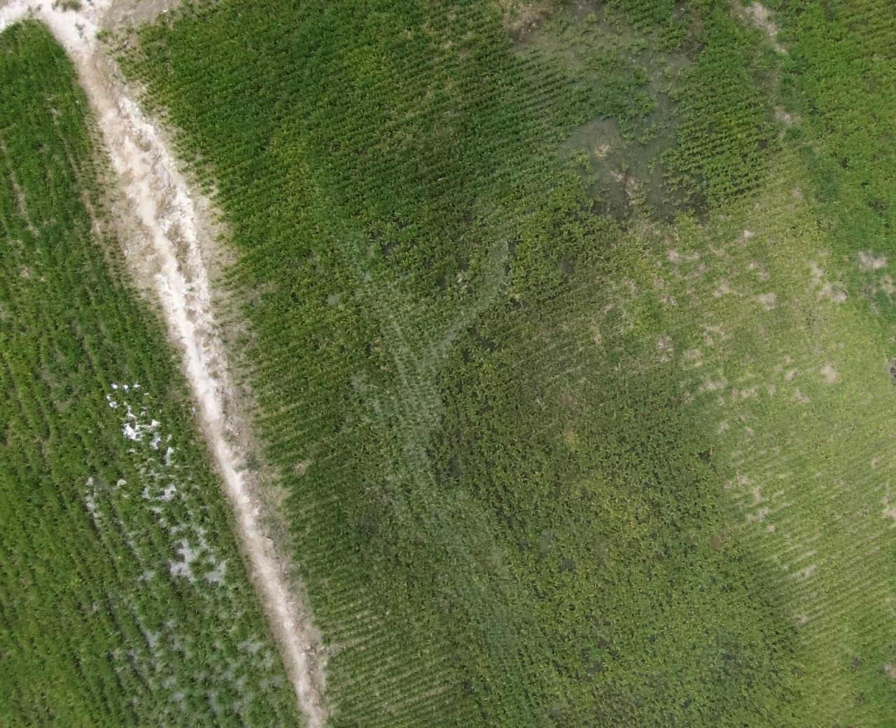
Remote Sensing & Imagery

We acquire and curate multi-temporal aerial and satellite imagery tailored to project boundaries, canopy structure, and monitoring frequency requirements. Source data is georeferenced, cloud-masked, and prepared for downstream analysis.

  • High-resolution aerial surveys over forestry reserves
  • Multi-spectral and RGB satellite composites
  • Automated cloud, shadow, and artefact masking
  • Consistent tiling and CRS normalisation across campaigns
Geospatial data processing pipeline for carbon analytics
Processing

Geospatial Data Pipelines

Cloud-native workflows transform raw imagery into analysis-ready datasets. Segmentation, canopy metrics, and change layers are produced with version control so results can be reproduced and audited at any point in time.

  • Automated orthorectification and mosaicking
  • Canopy cover, height proxy, and density indices
  • Temporal differencing for growth and degradation
  • Quality assurance gates at each pipeline stage
Allometric carbon models applied to forestry biomass
Modelling

Carbon & Allometric Models

Calibrated allometric equations convert structural forest metrics into biomass and carbon stock estimates. Models are tuned to local species composition and validated against ground reference where available.

  • Above-ground biomass estimation from canopy metrics
  • Methodology-aligned emission and removal factors
  • Uncertainty quantification and confidence intervals
  • Baseline and project scenario comparison over time
API integration and registry-ready data exports
Integration

API & Registry Exports

Outputs are delivered in formats your team and registries can consume directly. Structured APIs, geospatial layers, and tabular reports connect field evidence to issuance workflows without manual reprocessing.

  • REST API access to monitoring datasets and metrics
  • GeoJSON, raster, and CSV export packages
  • Webhook notifications on verification milestones
  • Registry-formatted report generation

Platform capabilities

Built for teams that need defensible data, not just dashboards.

Versioned datasets

Every processing run is logged with inputs, parameters, and outputs for full reproducibility.

Automated QC

Rule-based checks flag anomalies in imagery, geometry, and model outputs before sign-off.

Multi-spectral analysis

Extract vegetation indices and structural proxies from calibrated spectral bands.

Permanence tracking

Monitor degradation, fire risk, and land-use change against project boundaries over time.

Audit trails

Link each credit claim to the underlying geospatial evidence and processing history.

Scalable compute

Process large forestry portfolios in parallel without compromising analytical rigour.

Data flow

From imagery to issuance

Our technology stack mirrors the MRV lifecycle. See how measurement, recording, and verification connect in our MRV framework.

  1. 01

    Ingest

    Acquire and validate imagery against project geofences and monitoring schedules.

  2. 02

    Process

    Run geospatial pipelines to extract canopy structure and change layers.

  3. 03

    Model

    Apply allometric and carbon models with documented uncertainty bounds.

  4. 04

    Deliver

    Export verified metrics via API and registry-ready reporting packages.

See the platform in action

Request a technical walkthrough of our geospatial pipelines, model outputs, and API integration options for your project.

Request Demo